- Community Spotlight
- Environmental Resource Assessment & Management
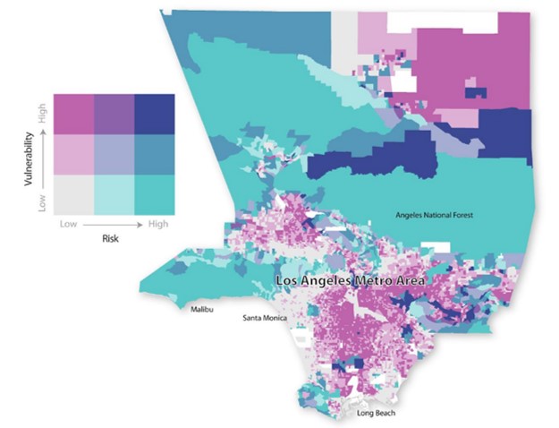
Assisting with a Risk and Vulnerability Assessment
Los Angeles County in California is a densely populated area vulnerable to natural hazards such as flooding and wildfires. Our staff modified and applied the Integrated Vulnerability Assessment Framework developed by NOAA’s National Centers for Coastal Ocean Science to assess the county’s climate vulnerability. Through partner and stakeholder engagement, the team used a series of maps to identify areas at risk of wildfires, projected coastal flooding, and other selected risks. The team then explored how those risks align with social, structural, and environmental vulnerability. These maps and information are already supporting development of local climate action and sustainability plans. This work was supported by several staff on contract with two NOAA offices: the National Centers for Coastal Ocean Science, and the Office for Coastal Management.
See More CSS Community Spotlight
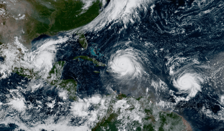
Supporting Hurricane Preparedness and Response
June 1 marks the beginning of hurricane season, but CSS employee owners work throughout the year to help communities prepare for and respond to hurricanes year-round. Through several contracts, CSS helps clients develop tools and content and manage data to provide resources communities and decision-makers can use for hurricane preparedness and response. Explore a few…
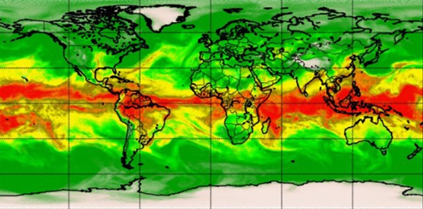
Advancing Severe Weather Predictions with Artificial Intelligence
As artificial intelligence (AI) and machine learning (ML) technologies evolve in Earth sciences, CSS employee owners (formerly Riverside staff) are growing our expertise in this field. CSS employee owners are advancing technologies for our client, NOAA’s Center for Satellite Applications and Research (STAR). Our staff have developed a framework, exploiting modern AI/ML techniques, to rapidly…
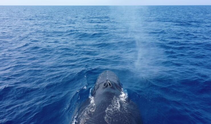
Training Marine Mammal Programs to Use Drones to Collect Dolphin and Whale Respiratory Health Data
CSS employee owner and Marine Mammal Drone Specialist supports NOAA’s National Centers for Coastal Ocean Science (NCCOS) Marine Mammal Health Assessment team with collecting respiratory health data from marine mammals in local waterways. Using specialized drones equipped with petri dishes provides a non-invasive method to collect exhaled breath (i.e. blow) samples from dolphins and whales.…