- Uncategorized
- Environmental Resource Assessment & Management
Supporting Wetlands Today and Throughout the Year
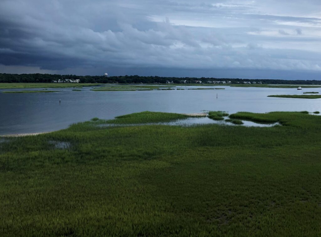
February 2 is World Wetlands Day, a day to celebrate and honor these invaluable ecosystems. Through a variety of projects on several contracts, our employee owners support wetlands throughout the year. Below are some examples of projects that CSS works on to support wetlands and promote the benefits they provide.
- National Wetland Condition Assessment. Our employee owners have supported research in wetland biogeochemistry and ecology for over two decades through our contract with the U.S. Environmental Protection Agency Pacific Ecological Systems Division in Corvallis, Oregon. Much of this work has been associated with National Wetland Condition Assessment as part of the EPA National Aquatic Resources Surveys. CSS staff helped develop field protocols, analyze water samples, and conducted field surveys.
- Field Studies. Through our contract with NOAA’s National Centers for Coastal Ocean Science, we have supported many projects related to wetlands around the country, including monitoring and assessing wetland restoration projects, using unoccupied aircraft systems to monitor wetlands, ecological assessments, economic valuation of wetlands for shoreline protection, and many more. Our scientists work in the field along with NOAA scientists to study and collect data that will be useful to coastal communities and decision-makers.
- National Estuarine Research Reserve System. Our employee owners primarily serve as coastal management technical experts and liaisons between the national estuarine research reserves and NOAA’s Office for Coastal Management (the agency that manages the system in partnership with state agencies, academic institutions, or non-profit organizations). The estuarine reserve system protects nearly 1.4 million acres of estuarine, wetland, riverine, forest, and open water environment.
- Data and Tools. Through the contract with NOAA’s Office for Coastal Management, our staff develop and manage data, tools, and training that help coastal managers understand the benefits of wetlands. These products include Land Cover Data, Sea Level Rise Viewer, Coastal County Snapshots – Wetland Benefits, and the Coastal Flood Exposure Mapper.


See More CSS Insights

Providing Data Products for More Effective Consumption
The National Oceanic and Atmospheric Administration’s (NOAA) National Centers for Environmental Information (NCEI) is responsible for providing data, products, and services that help businesses and organizations operate more efficiently and effectively. As such, these data and products need to be available in a publicly accessible and digestible format the audience are able to understand. To…

Monitoring Air Quality in California’s San Joaquin Valley
CSS employee owners supported the deployment and operation of the U.S. Environmental Protection Agency (EPA) air quality monitoring trailer (WEAVE COM – Western Enhanced Air quality VEhicle for COmmunity Monitoring) in California’s San Joaquin Valley in during late fall and early winter of 2024. Elevated particulate matter (PM2.5) is frequently found throughout the valley during…

Over 40 Years of Support
Since 1982, members of our staff have supported EPA’s Office of Pesticide Programs. As part of this contract, our staff assess environmental and human health impacts on anthropogenic chemicals. The agricultural industry is critical to food and textile production, it is a large contributor to the U.S. economy. Not only does the industry provide food…